
For those keeping track, we have now identified 6 potential archaeological sites in Laguna and Batangas in the Southern Luzon region for further research as part of the PANTROPOCENE Project. Our research goals include attempting to quantify land-use changes in the Philippines prior to the arrival and after the establishment of the Spanish Empire in the Philippine archipelago. We will be undertaking palaeoenvironmental, remote sensing, and archaeological fieldwork and use the resulting data, alongside that from other parts of the Spanish colonized world, to build up broader understandings of the impacts of European colonialism across the tropics.
To this end, we visited locales in San Pablo City, Laguna (Figure 1) in late September 2022 to assess potential areas for possible inclusion in the project as coring sites for the palaeoecological aspect of the project. We had already conducted coring activities in the eastern lobe of Laguna Lake off Binangonan, Rizal, and Lake Baao further south in Camarines Sur in July 2022. The coring sites we scouted have the potential to be areas that fit into the overarching goals of the project. They were identified as dry maar lakes by PANTROPOCENE team member and University of the Philippines School of Archaeology (UPSA) Research Associate Emil Robles while analyzing topographic maps and satellite imagery (Google Earth). The other member of the team is UPSA PhD student, Timothy James Vitales.
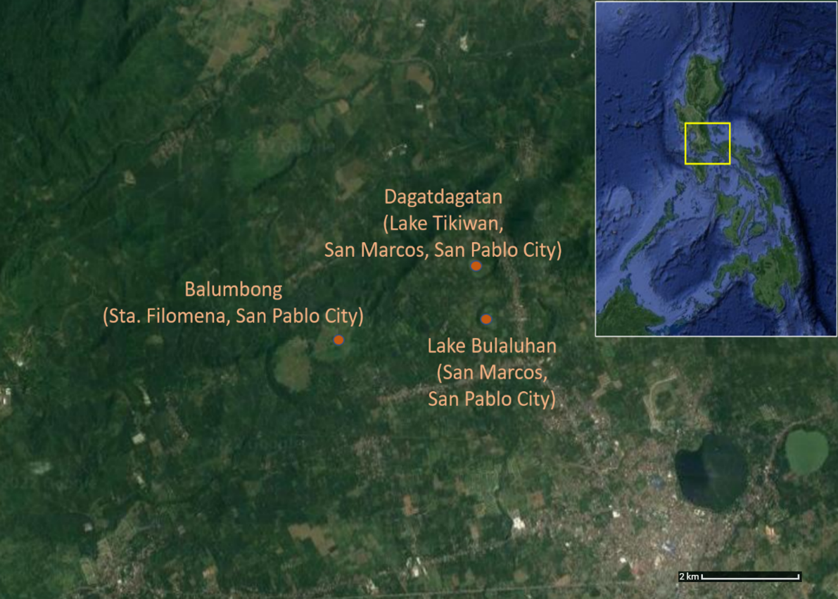
Figure 1. Map of study areas mentioned in text (Adapted from Google Earth by M. Mabanag)
Dagatdagatan (Lake Tikiwan, San Marcos, San Pablo City, Laguna)
One of the dry maar lakes identified by Emil in a previous survey for possible coring sites around the San Pablo lakes area is in Barangay San Marcos. We first viewed the lake from a promontory where a few people were building a house. One of the workers informed us that the lake is called Dagatdagatan (Fig. 2). The informants also referred to the lake as Lake Tikiwan. Our informants also mentioned there once was a spring in the location of the dry lake but that it has since disappeared.
We could also see from our vantage point that there were small patches of banana gardens at some points in the periphery of the lake. We were informed that we might be able to learn more about how to access the lake by speaking to one of the owners of the banana stands. Another bit of information we gathered is that the mountain overlooking the lake is said to be an extinct volcano (”patay na bulkan “) called Mt.Umabis. As we were leaving, we also looked down one of the holes that is in the process of being excavated in the property. We observed volcanic sediments in the stratigraphy starting about a metre from the surface but appearing more prominently in the terminal layer around 3 metres below the surface.
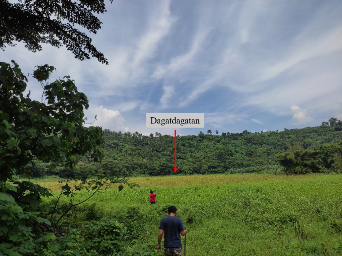
We went to the site by descending 24 metres down a path off a barangay road that is commonly used by locals. The area is overgrown with wild vegetation and the ground is wet and soft. Because of this, we were not able to go closer to the lake. According to a local resident we interviewed, the lake itself is under the jurisdiction of the local barangay. This was confirmed by the Barangay Chair during our courtesy visit. We were also informed that, aside from Dagatdatan, another dry maar lake we were looking for is located within San Marcos’ jurisdiction as well. The Barangay Chair relayed to us the local government would be open to collaborating with us for any future coring activities we will be conducting.
This was good news. Having the barangay representatives eager to help in any future coring activity is a major boost. Getting the approval of the head of the barangay gives us legitimacy and opens doors for us. Through their lead, residents of the barangay will also accept us into the community. During my first forays into archaeology, and has been confirmed in my years of doing field work in many different areas of the Philippines, gaining the locals’ trust is one of the more to-do prerequisites. I am also foreseeing we will be recruiting them to provide us guidance and assistance during the field work.
Bulaluhan (San Marcos, San Pablo City, Laguna)
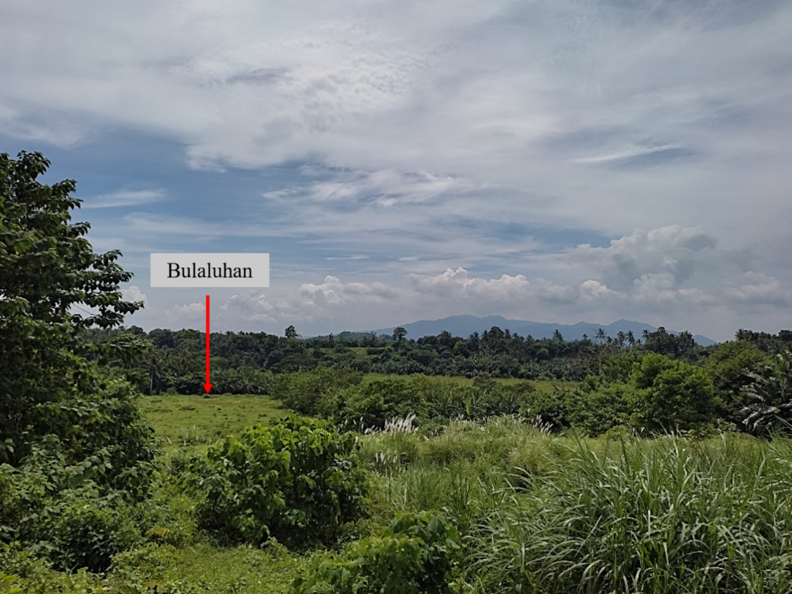
Another dry maar lake we were aiming to survey is one that is divided between two barangay jurisdictions-San Marcos and San Mateo, as relayed by the San Marcos Barangay Chair. The site can only be accessed by entering a subdivision under development by Luisville San Marcos Land Development Corporation. Accompanied by a representative of the barangay, I spoke with the supervisor of the construction project. With the support of the barangay local government, we were given permission to enter the private development to view Bulaluhan (Fig. 3). We were not able to get closer to the site as there was no visible path. If we were to continue to conduct coring activities in Bulaluhan, we will be collaborating with Barangay San Marcos.
Balumbong (Santa Filomena, San Pablo City, Laguna)
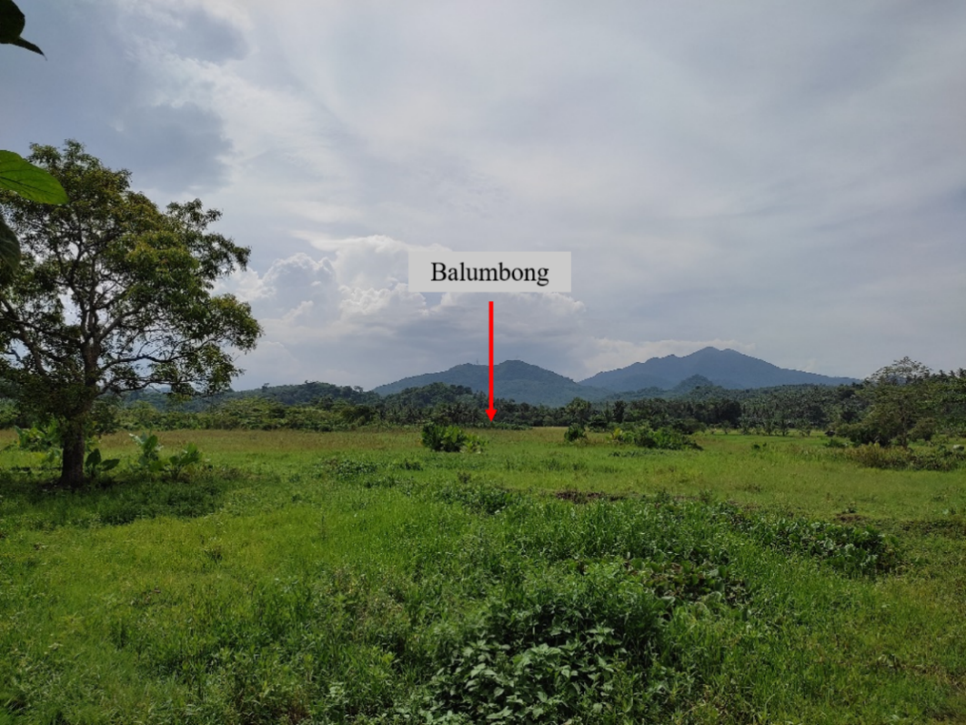
The next dry maar lake we surveyed is called Balumbong (Fig. 4). We had to descend 71 metres using a cement staircase to arrive at the site. The surrounding area has a spring that is being used by local tourists. There is also an irrigation system in the periphery of the area. It appears that the area is being used as pasture land for carabaos and other animals to graze. We were not able to come closer as the ground was wet and too soft to walk on.
A few young informants we met along the way to the site informed us that the site is under Barangay Perez in Calauan, a town neighboring San Pablo City. However, when we made a courtesy call to the nearest barangay hall (Santa Filomena), we were informed that the lake is divided between Perez and Santa Filomena. Santa Filomena is a barangay under the jurisdiction of San Pablo City. According to a barangay representative, the lake is also called Nangog. This is because of the force of the spring that spouts at the site, and the water level can get very deep especially during the wet months. The same representative (also head of tourism for the barangay) relayed that they would also be open to collaborating with us if coring activities would continue at Balumbong.
Next Steps
Upon consultation with Emil, coring can be done at one or two sites – either in Dagatdagatan and in Balumbong or in either one as the represented catchment area would be the same for both lake cores. We will have to use a bamboo raft as a platform, especially if the middle of the dry maar lakes has a deep accumulation of water, which seems to be the case for Balumbong. Another suggestion is to first excavate manually to a certain depth then employ the use of a piston corer to obtain a core sample, though this may result in the loss of upper sediments recording the land use history of the recent past.